UTM30 - Surveying equipment
0,00
€
0
Cart
Home
Products UTM30
GNSS receivers
Total Stations
Controllers
Drones
LiDAR & Laser Scanner
Packs Offer
Rental
About us
Contact
Menu
Home
Products UTM30
GNSS receivers
Total Stations
Controllers
Drones
LiDAR & Laser Scanner
Packs Offer
Rental
About us
Contact
Offers of
Spring
. Launch of the brand
INTEC
, with promotional prices. Contact us by Email or WhatsApp
Home
/
Drones
/ Geosun LiDAR GS-100C plus
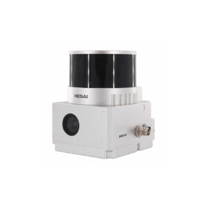
Geosun LiDAR GS-100C+
Laser scanner for drone mounting
LiDAR and photogrammetry
720,000 points / second
Triple pulse
Accuracy < 10 cm
26 Mpx camera
Includes GNSS RTK module
Includes post-processing software
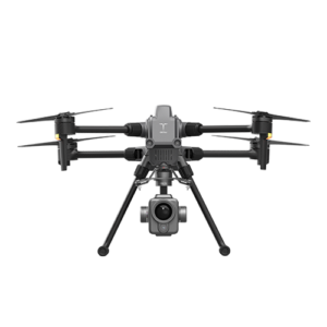
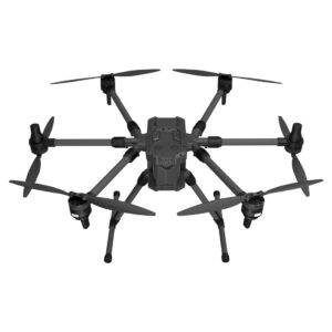
Compatible with DJI and Yuneec drones
Request an offer
Geosun LiDAR GS-100C plus
Description
Specifications
Description
Laser scanner for mass data capture and LiDAR point cloud creation.
Specifications
SYSTEM PARAMETERS
Weight
1022g
Measuring accuracy
Less than 10 cm (110 m AGL)
Power range
12V~16V
Working temperature
-20℃~+55℃
Consumption
Average 20W
Support platform
GS-800 Multi-rotor, fixed wing VTOL
Storage
64 GB storage, 128 GB TF card maximum support
LIDAR UNIT
Laser model
Livox Avia
Measuring range
190m@10% Reflectivity
Laser class
905nm Class 1 (IEC 60825-1:2014)
Laser line number
Equivalent to 64 beams
Range accuracy
2cm
Data
Triple echo, 720,000 dots/sec.
Field of vision
70° circular view
GNSS UNIT (POS)
Update frequency
200 Hz
Head-end precision
0.040°
Pitch accuracy
0.015°
Rolling precision
0.015°
Position accuracy
0,02 - 0,05 m
GNSS signal type
GPSL1 / L2 / L5 GLONASS L1 / L2 BDS B1 / B2 / B3 GAL E1 / E5a / 5b
POST-PROCESSING SOFTWARE
Field software
Departure information: position, speed, altitude
Point cloud software
Output point cloud data format: LAS format, custom TXT format
INTEGRATED CAMERA
field of vision
83º
Effective pixel
26 Mpx
Triggering event
Distance or time trigger
Related products
Geosun GDU S400E
View product
Geosun G-850
View product
Geosun LiDAR GS-100V
View product
Go to products
Category:
Drones
ES
ES
EN
FR
IT
PT
DE
ES
ES
EN
FR
IT
PT
DE
Request for offer
Name:
Email:
Telephone:
Product:
Comments:
Send